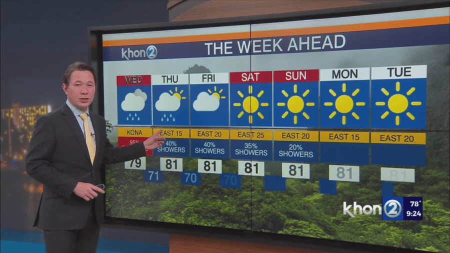
HONOLULU (KHON2) — A cold front will begin to cross over the islands, bringing much-needed rain to the islands starting early Thursday. Some showers may be heavy at times. Trades are expected to return Thursday with drier conditions statewide by early Saturday.
- Tonight: Expect breezy west-northwesterly winds as the front passes. Some rain is possible across the islands, especially in usually dry areas.
- Tomorrow: The front will stall near Oahu and Molokai. Breezy northeast winds will develop.
- Thursday-Weekend: Trade winds return, bringing showers to windward areas. A passing upper-level disturbance could increase showers and even thunderstorms, especially from Oahu to the Big Island.
- Big Island summits: Possible wintry precipitation late Thursday through early Saturday.
- Next Week: Trade wind weather will return as the disturbance moves away.
Need 2 Know:
- Cold front: Arriving tonight, bringing rain and wind changes.
- Showers: Increasing Thursday-Weekend, with possible thunderstorms.
- Big Island: Potential for wintry weather on summits.
- Next Week: Return to typical trade wind conditions.