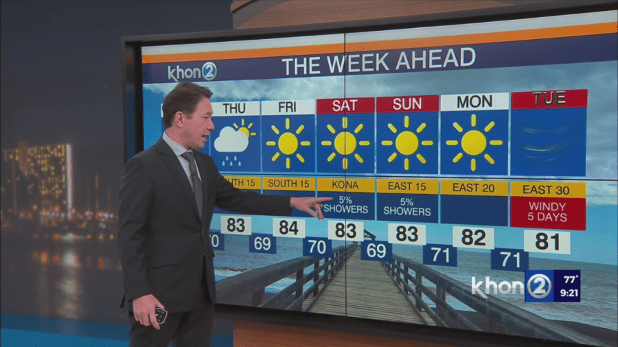
HONOLULU (KHON2) — After a brief return of the trade winds Tuesday, southerly winds will take over as a storm front nears the islands during this time. Early morning showers are expected Thursday before drier than normal conditions return Friday and this weekend. Next week, winds speeds could ramp up as trades strengthen to 30 mph with higher gusts. Depending on humidity levels, this may put the islands at a higher brushfire risk. For now winds remain light through the end of this week.
Rest of This Week (Wednesday-Late Week):
- A cold front is approaching, causing a transition period from dry to wetter weather.
- Low-level winds will shift from south.
- Increased moisture and lift will enhance rainfall, especially on leeward slopes and mountains in the western areas.
- Rainfall amounts are expected to be limited due to the front likely stalling near or north of Kauai.
Weekend Outlook (Saturday-Sunday):
- A return to light to moderate trade winds and drier conditions is possible by the end of the weekend.
- A cold front passing far to the north on sunday, could drag its tail end boundary into the western islands early next week.
- This tail end of the front could bring an increase in rain chances.