The eastern islands of Kauai and Oahu are experiencing moderate to locally breezy trade winds, while light to moderate trade winds prevail over the western islands of Maui County and Hawaii Island . Satellite images show mostly cloudy conditions in windward areas and partly cloudy skies in most leeward areas. Radar indicates generally dry conditions across the state, with a few showers in windward regions and diminishing daytime showers in some leeward areas.
The low west-northwest of the state will gradually move westward, away from the islands, over the next couple of days. This will allow trade winds to strengthen gradually from east to west, bringing moderate to breezy conditions statewide by Thursday. Reinforcing highs will build north of the state from Friday through early next week, while the low continues to move further west, maintaining moderate to breezy trade winds across the islands.
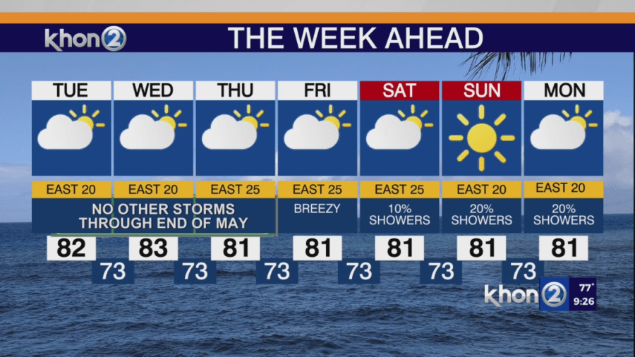
Fairly dry conditions are expected tonight into Tuesday morning, with light showers mainly on windward slopes and coasts. A band of trade showers moving in from the east Tuesday afternoon will bring an increase in trade wind showers to the eastern islands of Maui and Hawaii Island . A few leeward and interior showers may occur over the western islands and leeward Big Island Tuesday afternoon, but these should diminish quickly by evening, with showers focusing on windward areas Tuesday night into Wednesday morning. Starting Wednesday night or Thursday, we should transition to a more typical trade wind pattern with mainly windward/mountain showers and occasional leeward spillover, mostly during overnight and early morning hours. This pattern is expected to continue through early next week.
Heavy rain is not expected during the upcoming Memorial Day weekend.
Small Craft Advisory until 7 AM HST Wednesday for Pailolo Channel, Alenuihaha Channel, Big Island Leeward Waters, Big Island Southeast Waters.