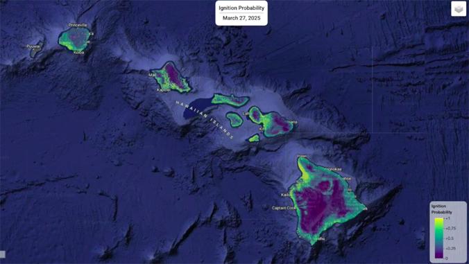
HONOLULU (KHON2) — University of Hawaiʻi scientists developed a new wildfire risk map to help predict fire danger across the islands.
“This new mapping system gives us a clearer, more detailed picture of wildlife risks across Hawaiʻi. By providing daily updates and a long-term dataset, we hope to improve preparedness and help protect communities from future fires,” said Professor Sayed Bateni of UH Manoa.
The map is available online via the Hawaiʻi Climate Data Portal, where anybody can zoom in around the islands to view data on the risk of wildfires in that area.
The information on the map is gathered from real-time data obtained from numerous weather networks across the islands, such as the Hawaiʻi Mesonet.
“It’s all about improving preparedness, especially in light of recent disasters like the devastating fires in Los Angeles and the tragic Lahaina fire,” said Tom Giambelluca, former UH professor and leader of the Hawaiʻi Mesonet. “With real-time data on factors like soil moisture, we can better identify areas at high risk for wildfires or flooding.”
Funding for the maps was provided by the Hawaiʻi Emergency Management Agency, Federal Emergency Management Agency and the Hawaiʻi State Legislature.
“The mapping system is a game changer for wildfire preparedness in Hawaiʻi,” said Clay Trauernicht, an assistant specialist at UH Manoa. “Using current data allows us to better anticipate fire risks and take proactive measures to protect communities.”