HONOLULU (KHON2) – Broad high pressure far north of the islands is driving moderate to locally breezy trade winds across the state.
Regional infrared satellite imagery shows an area of showers and thunderstorms roughly 550 nm west of Kauai associated with a surface trough and its attendant low aloft.
This feature is also causing local trades to veer slightly more east-southeasterly than usual, particularly across the western islands.
Locally, afternoon soundings from Lihue and Hilo show mostly stable conditions, and latest radar imagery shows only a few light showers around the state.
Through Tuesday, little change is expected in the overall pattern as high pressure gradually strengthens to the north/northwest and the trough and upper low west of the state remain nearly stationary.
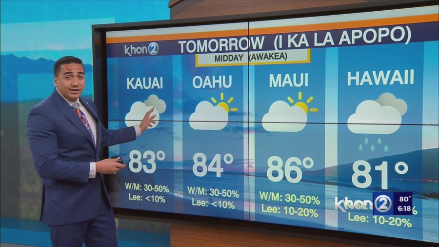
Shallow moisture embedded within the trades will produce some windward and mauka showers at times, particularly during the overnight through early morning hours each day.
Additionally, expect spotty afternoon and evening showers, some briefly heavy, across leeward portions of the Big Island.
The trough’s proximity to the western end of the state will weaken the inversion at times near Kauai and could enhance shower activity there, similar to last night.
However, guidance is in agreement that the trough will remain far enough west of the main Hawaiian Islands to have little impact to local weather otherwise.
For the rest of the week, the surface high will settle far northeast of the state and hold into Friday while the surface trough lingers west of the islands and produces breezy easterly trade winds.
The nearby upper-level trough will weaken around mid- week, leading to greater stability and supporting a more typical trade shower pattern favoring windward and mauka areas.
Small Craft Advisory until 6 PM HST Monday for Pailolo Channel, Alenuihaha Channel, Big Island Leeward Waters, Big Island Southeast Waters.