HONOLULU (KHON2) – A 1033 mb high remains nearly stationary far northeast of the state.
Water vapor imagery shows a compact upper level low several hundred miles north of us that is slowly drifting westward.
Even with the upper low nearby, 00z soundings show a typical subsidence inversion just under 7kft at Lihue and down to 5kft at Hilo.
Rainfall amounts across the state have been roughly a quarter to a half inch over the past 12 hours, with more of those reports across Kauai and Oahu.
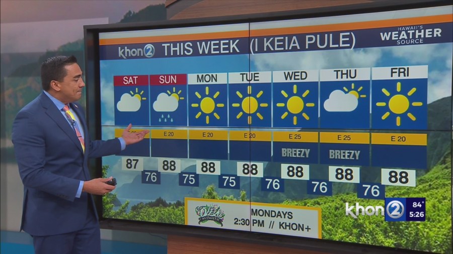
The high northeast of the state will gradually shift northward over the next couple days, but we’ll remain in a pretty consistent trade wind flow.
While the upper low is expected to stay north of the state, a shortwave trough rotating around it will help raise inversion heights this weekend.
A pocket of moisture just outside the offshore waters, apparent as a showery band of cumulus on satellite imagery, will enhance rainfall chances this weekend.
Trade winds speeds may lower a bit but still remain borderline breezy.
While the trades will focus most rainfall across windward sections, there will be some brief showers reaching leeward areas as well.