HONOLULU (KHON2) – A persistent 1038 mb surface high is centered far north northeast of Hawaii this afternoon driving moderate to fresh trade winds.
A weak surface trough moving onto the island chain from the east is causing a brief weakness in the wind flow and is expected to bring a round of showers mainly to windward areas overnight.
The trough extends past 700 mb (10,000 feet) which could result in some moderate intensity trade wind showers, and possibly bring a few to leeward sides of the smaller islands.
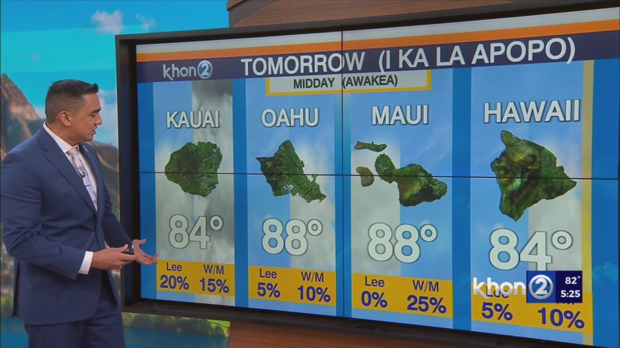
Showers may linger around Kauai Tuesday morning as the trough weakens, but overall expect a drier and more stable environment and strengthening wind speeds Tuesday.
Little change is expected to forecast Tuesday through Friday with any incoming clouds and showers impacting windward slopes occurring mainly at night.
A broad, weak upper low will set up over and north of the islands by late Friday.
A slight increase in shower trends are anticipated mainly during the overnight to early morning hours favoring the windward and mountain areas through the weekend.