HONOLULU (KHON2) – Mid-level ridge axis extending westward from 593dm mid-level ridging anchored east of the islands maintains strongly stable conditions today, particularly over the eastern end of the state.
Water vapor provides a clear picture of the stability gradient currently in place with very dry mid-level air pivoting around the high and over Maui and the Big Island while lingering cyclonic flow aloft associated with low pressure west NW of Kauai supplies modest mid- level moisture over the western end of the island chain.
The aforementioned mid-level high is displaced south in response to deep troughing advancing eastward over the NE Pacific.
This in turn has suppressed the seasonably weak trade wind belt to the south resulting in moderate trades that will persist into early next week.
Limited rainfall windward and mauka during this time owing to high stability and a lack of upstream moisture.
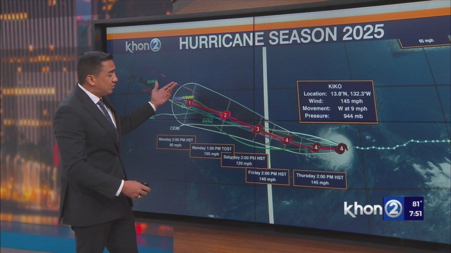
The end of the forecast period will feature the passage of TC Kiko, which is presently moving quite slowly westward in the eastern Pacific Basin.
The track of this cyclone will be governed by its intensity and interaction with steering flow, the latter of which will be modulated in part by deepening mid-latitude troughing near the islands as it approaches.
A flash flood threat may develop over the islands in the Tuesday-Thursday time frame conditional on the exact track of the system.