HONOLULU (KHON2) — As of last night, Sept. 6, the forecast expects rain chances to increase across the islands Sunday into early Monday as an upper low and deeper trades bring more showers, mainly for windward and mauka areas overnight, with spotty heavy showers inland during the afternoon.
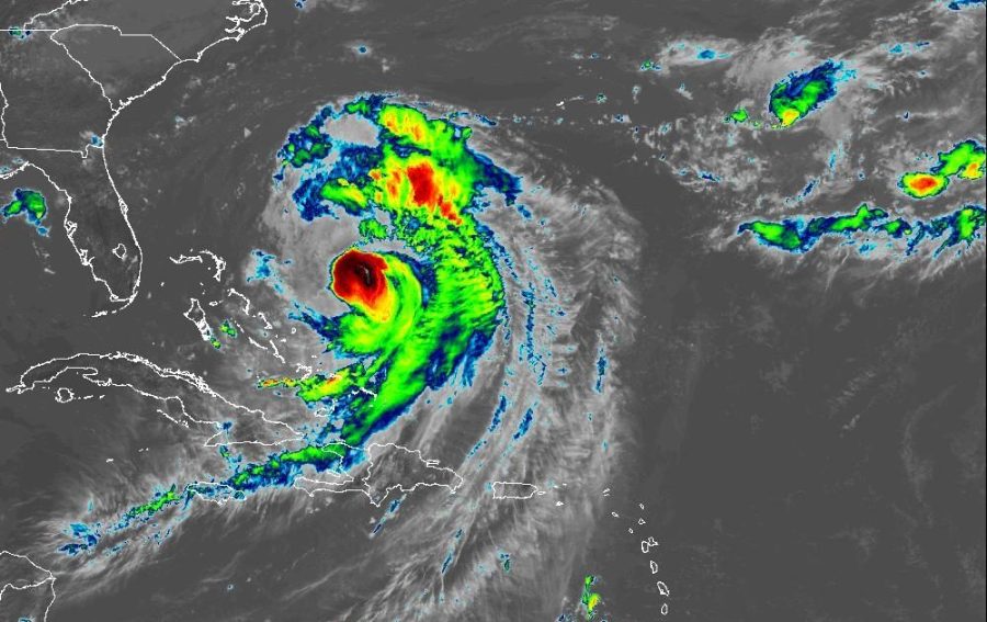
Kiko remains a powerful Category 4 storm about 900 miles east-southeast of Hilo, moving west-northwest. The system is expected to rapidly weaken and pass north of the islands as a tropical storm.
Confidence is increasing that Tropical Cyclone Kiko will pass far enough north of the state next week, decreasing the likelihood of any direct impacts to Hawaii.
With lighter winds and added tropical moisture, expect periods of heavy afternoon showers over island interiors through midweek, with a windward focus at night.
Check out more news from around Hawaii
Stay tuned to KHON2, Hawaii’s Weather Source, for all updates on Kiko’s forecast track.