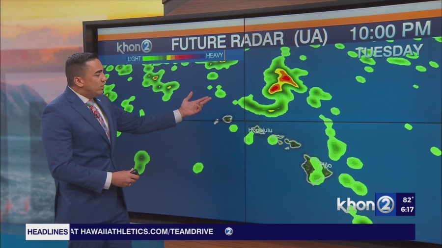
HONOLULU (KHON2) – The trailing band of moisture extending from TC Kiko to waters well east of the Big Island will advance west through the area tonight and Wednesday.
This band resides along the convergent lead edge of high pressure that will build into the area during the medium range.
A wide coverage of showers over windward portions of the Big Island and Maui can be expected tonight mainly after midnight and mainly over areas exposed to ESE flow.
Weak capping will favor localized heavy downpours, but the general expectation is for rain rates to remain below 1″ per hour.
This band of moisture will be positioned over the central portion of the state during the day Wednesday.
Emerging ESE flow poses the primary uncertainty in the forecast as it is modeled to be nearly strong enough to wipe out the sea breeze influence, a necessity for low-level forcing tomorrow.
Locally breezy trades then return from Wednesday night onward while building upper riding provides ample stability.
Showers focused windward and mauka during this time, mainly during the overnight and early morning hours.
High Surf Warning until 6 AM HST Wednesday for Olomana, Kauai East, Kauai South, East Honolulu, Koolau Windward.
High Surf Advisory until 6 AM HST Wednesday for Maui Windward West, Molokai Windward, Molokai Southeast, Windward Haleakala, Kipahulu.
Small Craft Advisory until 6 AM HST Wednesday for Kauai Northwest Waters, Kauai Windward Waters, Kauai Channel, Oahu Windward Waters.