HONOLULU (KHON2) – Radar has noticeably quieted down since this morning and, while many windward areas and ridge tops will remain mostly cloudy and experience those hit or miss brief showers, an overall drier trend is anticipated through Monday.
Trades have eased just enough to allow the local breezes to kick in over more wind sheltered regions as leeward Big Island and west Maui.
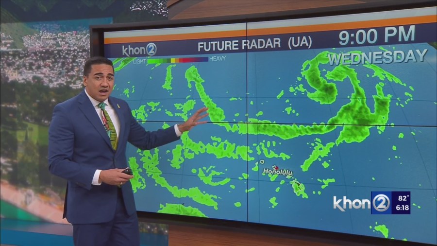
After a couple of days of similar somewhat unsettled partly cloudy weather, a deepening Central Pacific trough will increase rain chances Wednesday.
A mid to upper level low will develop along the trough axis Wednesday and dive further south toward Hawaii.
This scenario will weaken trade flow and direct a higher channel of moisture toward the western end of the islands during the second half of the week.
While the low is not expected to get much closer than five or six hundred miles northeast of the island chain, its associated trough could drape over the state.
This may result in cloudier days with more frequent showers in closing out the week.
The nature or movement of this trough axis will determine if next weekend will lean towards more wet or not.
Western ridging is expected to strengthen and lift the trough northeast early next week. Surface high pressure does not appear to re-establish itself by Monday as weak lower level troughing lingers into next week.
This means that, while trades will return along with scattered showers from continued bands of higher easterly moisture, they will remain light enough to allow small scale breezes to remain dominant across many leeward or non east- facing communities.