HONOLULU (KHON2) – Light to locally moderate winds will continue through the rest of the weekend.
Latest global models show a surface trough developing just northeast of the islands on Monday, with a well-defined low aloft.
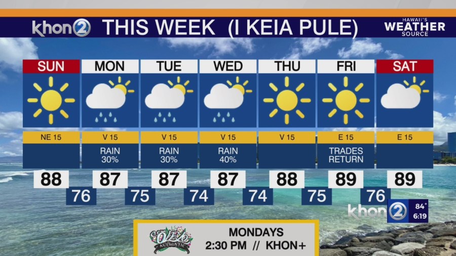
This trough will move near and then over the western islands from Monday morning through mid-week, then will become less defined as it weakens by mid-week.
Throughout this time, background wind flow will become weak and veer east-southeasterly.
As a result, island heating will support sea breezes each day, and overnight cooling will drive land breezes each night. In this pattern, daytime sea breezes will enhance leeward and interior shower activity, while land breezes overnight will clear the night skies, limiting showers.
This sea breeze/land breeze regime is forecast to continue through latter half of the week until the aforementioned surface trough exits the vicinity of the islands late Friday.
Moderate trade winds look to return to the islands next weekend.