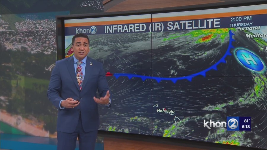
HONOLULU (KHON2) – A cold front 900 miles north of Hawaii will slowly approach over the next several days.
The front is forecast to weaken through Saturday before an upper low cuts off out of the North Central Pacific and quickly moves towards the state passing just northwest of Kauai on Sunday before moving away to the west.
The upper low will induce a trough at the surface directly over the islands on Sunday.
Winds will weaken slightly and shift out of the southeast around Big Island and Maui County and out of the northeast for Kauai and Oahu.
Clouds and showers will increase as early as Saturday afternoon for the Big Island, and statewide Saturday night into Monday, as frontal moisture moves in over Kauai and Oahu.
Winds will shift back to trades as the trough moves west of the state Sunday night and Monday following the upper low.
Trades will push clouds and showers in place over the state Monday keeping conditions quite wet.
Main heavy rain potential lies in the brief passage of the upper low over the low level frontal moisture, which coincides across the far western end of the state Sunday and Sunday night.
Considering a Flood Watch for Kauai during the Sunday to Sunday night time period, with particular emphasis on the north and east sides of the island.