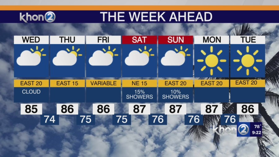
HONOLULU (KHON2) — High pressure will weaken and drift northwest of the islands over the next few days, while a low pressure system to the northeast develops and moves west. This will cause the trade winds to gradually weaken through the end of the week. A drier airmass will then settle over the islands, through the weekend.
A low pressure system is located 1100 miles northeast of the state, with a strong high pressure system to the northwest, resulting in breezy trade winds this evening. Thick high cirrus clouds are covering most of the state.
Tonight, the windward sides of the islands will see some lingering clouds and showers due to remaining moisture and the usual increase in showers in the evening. Shower activity is expected to be light.
Friday night into Saturday may bring increased cloudiness and showers to windward areas due to some bands of showers and enhanced moisture. The high cirrus clouds should thin out by Wednesday but will generally remain through the week. By the weekend, a high-pressure system could strengthen northeast of the state and allow breezy conditions to return into early next week.