HONOLULU (KHON2) – A strong 596dm mid-level ridge remains parked directly over the islands in maintenance of ongoing mid-level subsidence and a stout trade inversion anchored around 6kft.
Locally, the islands remain along the northern fringe of the trades, which have largely been shunted south of the area.
Easterlies remain quite light owning to pressure falls across the central Pacific.
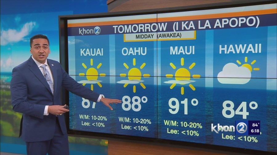
Trades check in this afternoon around 10 knots or less at most windward locales.
This has been just enough to steer modest shower activity over windward and mauka zones this morning into this afternoon.
A hybrid sea breeze pattern has emerged with increased leeward convergence leading to increased clouds and a just a couple very light showers over the most sheltered locations.
Subtle pressure rises near and north of the islands in the coming days will allow the trade wind belt to rebound slightly northward which will in turn favor locally breezy as early as Sunday evening and continuing through the first half of the week.
Extended model guidance maintains a strong consensus that weak mid-level troughing will cause trades to weaken once more late next week.
Overall, anticipate light windward/mauka rainfall through the week focused mainly overnight and during the early morning.