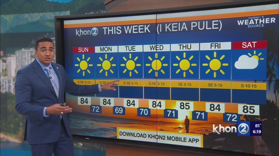
HONOLULU (KHON2) – Trade winds continue to gradually weaken this afternoon allowing for some localized sea breezes to develop over sheltered leeward areas.
Satellite imagery shows a few clouds building over these locations, but shower coverage has been minimal.
Expect winds to veer to the east-southeast tonight as the surface ridge just northwest of Kauai shifts south over the islands and weakens ahead of an approaching weak cold front.
With the lighter winds over the region expect land breezes to develop overnight and help to clear any lingering clouds over interior and leeward locations.
However, windward and mauka areas may continue to see a few clouds and light showers tonight.
Guidance continues to show the approaching cold front stalling just north of the islands late Sunday into Monday as it weakens further.
This will keep the bulk of the moisture and instability north of the state and help to limit rainfall chances on Sunday and Monday.
If this front sags south farther than anticipated we could see some higher rain chances over Kauai on Monday.
Otherwise, expect a continued focus for light showers over windward areas overnight and into the early morning hours, followed by some interior and leeward afternoon clouds and showers where sea breezes form.