HONOLULU (KHON2) – Easterly trade winds have been on the increase through the day as a surface trough just northwest of Kauai continues to weaken and a 1030 mb surface high remains to the far northeast.
Meanwhile, an upper level low is deepening approximately 600 miles northwest of Kauai.
Satellite and radar imagery show partly to mostly cloudy skies across the islands with a band of showery low clouds beginning to move into windward areas this afternoon.
Some leeward areas are also seeing some shower activity spilling over the mountains, especially over eastern portions of Oahu.
Even so, relatively stable conditions remain over the state, keeping rainfall totals around a tenth of an inch or less over the last few hours and highly localized.
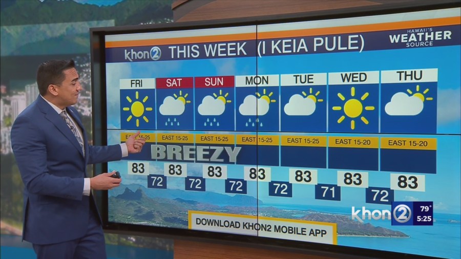
Trade wind speeds are forecast to increase into the breezy to locally windy range across the islands on Friday, then continue through the weekend as high pressure strengthens and settles in far northeast of the state.
Expect the strongest winds over the windier areas of Maui County and the Big Island.
Guidance continues to show the aforementioned upper low stalling to the west of Kauai this weekend, then slowly moving eastward across the state early next week.
As this happens, expect a boost in to our trade wind showers, especially during the overnight and early morning hours, with a few brief downpours possible through the first half of next week.
Some showers could drift over into leeward areas as well, due to the stronger winds.
Details are still uncertain, but windward and mauka areas could become quite showery through early next week, especially across the western end of the state where the best instability exists.
Some models also hint at an outside chance for some isolated thunderstorms during this time period.