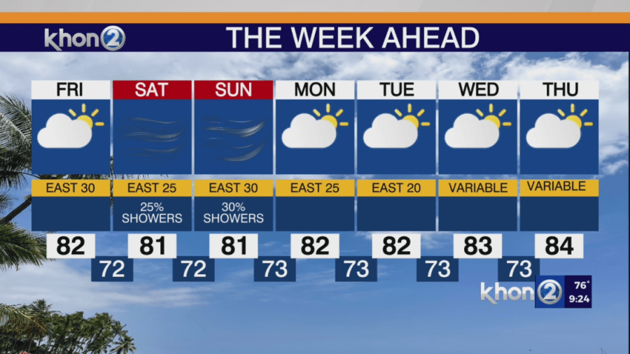
HONOLULU (KHON2) — A high-pressure system far northeast of the state will bring breezy to locally windy trade winds through the rest of the week. Showers will primarily affect windward areas, becoming more common at night. An upper-level low will move over the islands from Friday into early next week, leading to periods of increased trade showers in both coverage and intensity.
The high pressure to our northeast will strengthen slightly and move south-southeast, while the low to our west lifts northward slowly. This will result in a minor increase in wind speeds into the weekend. The low will dissipate through the weekend, as the high pressure northeast of the state moves a bit southwestward, closer to the islands by mid-next week, providing a slight boost to trades for the first few days of June. Trades are expected to be replaced with light and variable winds starting next Wednesday.