HONOLULU (KHON2) – Clouds and showers will continue to favor windward and mauka areas through the weekend with the typical diurnal uptick during the overnight hours.
Some of the showers overnight may spill into leeward areas at times and Kona Slopes of the Big Island can expect to see afternoon clouds and showers as the sea breeze develops.
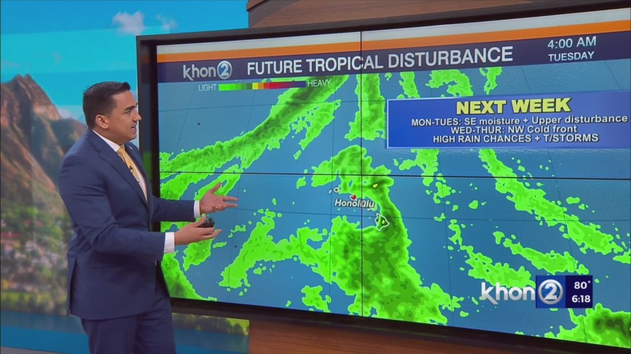
The through to the southeast of the Big Island will approach the state on Monday and pass to our south through Tuesday.
A slug of tropical moisture will accompany the trough as it approaches the state.
A passing upper level trough from the west will help to increase instability on Monday and will likely support locally heavy rain and a few thunderstorms across the Big Island so wouldn’t be surprised if a Flood Watch for the Big Island was issued later tonight or tomorrow morning.
At the moment the highest rainfall is expected across windward Big Island.
Some guidance does suggest windward Maui could see some locally heavy rain as the trough passes by, but the latest trend keeps the bulk of the moisture south of Maui as a front approaches from the northwest and prevent the trough from lifting further north.
Extended guidance continues to show the front to our northwest approaching the state towards the middle of next week then stalling over or just north of the islands.
High pressure will rebuild behind the front for the latter half of next week.
This will likely bring an uptick in northeasterly trade winds with breezy to locally windy conditions developing by late Wednesday across the state.
Meanwhile, another upper level trough will move across the state from the west.
This will likely bring wet trade wind conditions to the state late next week.