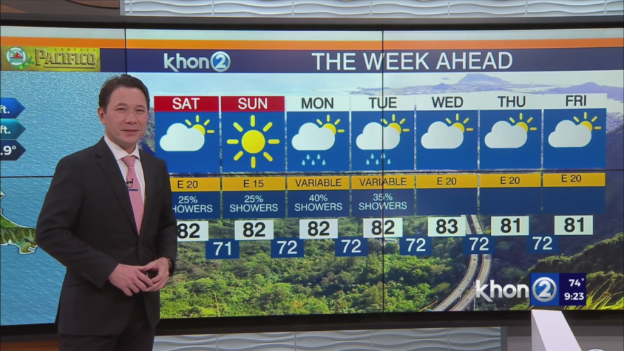
HONOLULU (KHON2) — Trade winds will gradually weaken and shift towards the east-southeast by early next week. Moisture plumes will generate passing showers across windward and mauka regions until Saturday. Sunday onwards, a drier weather pattern will prevail with light to moderate east to east-southeast winds. These winds are expected to be light enough for sea breezes during the day and land breezes at night, especially early next week.
Shower activity is forecasted to persist and intensify overnight into early Saturday morning, primarily targeting windward and mountainous regions, with scattered showers reaching leeward areas. Breezy conditions will persist tonight due to a high pressure system positioned 1200 miles northeast of the state.
On Saturday, the low pressure system will shift northeastward as the high pressure weakens slightly. Shower activity is anticipated to diminish throughout the day, except for leeward areas. With winds veering towards east-southeast and weakening, sea breezes are likely to develop over leeward areas, resulting in afternoon clouds and showers. Sunday is expected to see a decrease in showers and lighter winds with the development of sea breezes over many leeward areas in the afternoon, as a drier air mass moves in.
Early next week, high pressure will be positioned far northeast of the state while a low pressure system shifts northward. This will result in a hybrid wind pattern, with light to moderate east-southeast winds over windward areas and generally light winds over leeward areas. Limited moisture suggests minimal rainfall, primarily confined to windward areas, with some light showers possible over leeward areas during the afternoon as sea breezes develop.