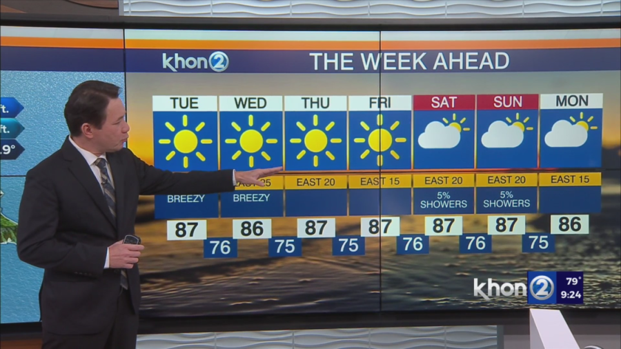
HONOLULU (KHON2) — A weak disturbance is moving westward through the islands this evening. Cloud bands are bringing showers to all islands, with the last of these bands clearing near the southeastern slopes of the Big Island. Some heavier showers are forming along leeward island areas, where brief bursts of rainfall are possible. Conditions should improve for the Big Island around midnight and gradually spread to the rest of the state by morning.
Another disturbance will arrive in the eastern islands on Thursday, likely increasing showers to Hawaii Island and Maui County through Saturday. A weak upper-level disturbance just east of the state might also create unstable clouds in the trade winds upstream of the islands.
Moderate to breezy trade winds will persist through Thursday.. Expect a slight decrease in trade winds, is expected starting Friday into the weekend.