HONOLULU (KHON2) — A Kona low northwest of the Hawaiian Islands will continue to bring periods of moderate to heavy showers to the central and western islands through at least Friday. A large band of heavy showers currently over Oahu, with rainfall rates around 1 inch per hour. Over the past 24 hours, Oahu has received 8 to 10 inches of rain in some areas. A Flood Watch is in effect for the western and central islands through Friday.
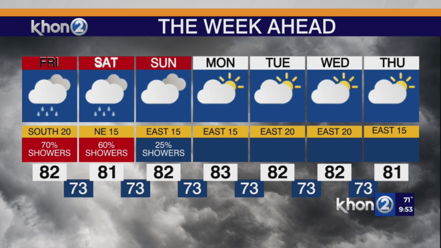
Expect periods of moderate to heavy showers, with isolated thunderstorms possible, mainly over Oahu tonight and potentially Molokai and Lanai. These showers will shift toward Kauai on Friday, with additional bands moving over Oahu. The main flooding risk is from showers that align and persist over one area, leading to significant rainfall, especially on already saturated ground. By late Friday, the low will move north, away from the islands, allowing the subtropical ridge to rebuild, resulting in more stable conditions and decreasing showers as east to southeast winds spread across the state this weekend.
By Sunday, the heavy rainfall threat will linger over Kauai, while more stable conditions develop statewide. Easterly trade winds will return from Monday, with only brief passing showers expected through midweek.