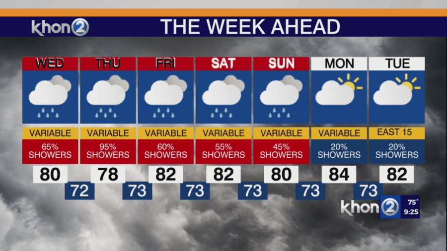
An upper-level low northeast of the state is creating unstable conditions this afternoon. Showers and convection have developed in many interior and mountain areas, remaining nearly stationary or drifting northward. These showers are expected to decrease this evening. Tonight, some showers may move in from the south, especially around Oahu, where satellite images show a plume of moisture south of the islands.
A kona low developing north of the state tonight will bring heavy rain starting Wednesday. This week there is less instability but much more moisture. The heavy rain will focus on leeward areas instead of windward areas. A a steady stream of rain along a band that will move eastward through Wednesday night, then stall around Oahu or Maui County before shifting westward toward Kauai on Friday. A Flood Watch is in effect for the entire state starting Wednesday, with the greatest chance of flooding on Wednesday and Thursday over Oahu and Maui County, while the Big Island has the least chance.
Flood Watch issued from Wednesday morning through Friday evening for all Hawaii islands.
