HONOLULU (KHON2) – The main forecast concern in the short-term is the potential for heavy rain and flooding, particularly for windward Big Island and Maui, starting late tonight and lasting through Tuesday.
A surface trough about 450 miles southeast of Hilo this afternoon can be clearly seen on visible satellite and will continue to advance towards the eastern end of the state over the next several hours.
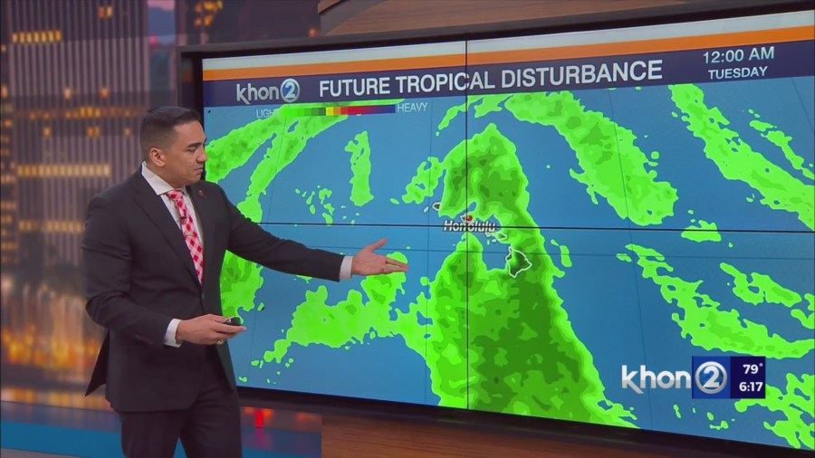
As this trough moves by to the south and its plume of moisture moves west-northwestward across the island chain tonight through Tuesday, a weak shortwave trough aloft will also set up over the state and bring increased atmospheric instability.
The low level trough, deep tropical moisture, and shortwave trough aloft look to all line up and bring the best chance of heavy rain even a slight chance of thunderstorms to windward Big Island and Maui Monday through Tuesday.
Model guidance suggests that a cold front will approach and potentially pass through the state sometime Wednesday through Thursday.
A new high pressure ridge building in north of the front Tuesday night is expected to lead to a resurgence in the trades, with breezy to locally windy conditions developing by late Wednesday and holding into next weekend.
High Surf Advisory until 6 AM HST Monday for Niihau, Kauai Leeward, Waianae Coast, Oahu North Shore, Maui Windward West, Kauai North, Molokai Windward, Molokai North, Molokai West, Maui Central Valley North, Windward Haleakala.
Flood Watch from late tonight through Tuesday afternoon for Maui Windward West, Maui Leeward West, Haleakala Summit, Kona, Kohala, Big Island Interior, Maui Central Valley North, Maui Central Valley South, Windward Haleakala, Kipahulu, South Maui/Upcountry, South Haleakala, Big Island South, Big Island Southeast, Big Island East, Big Island North.