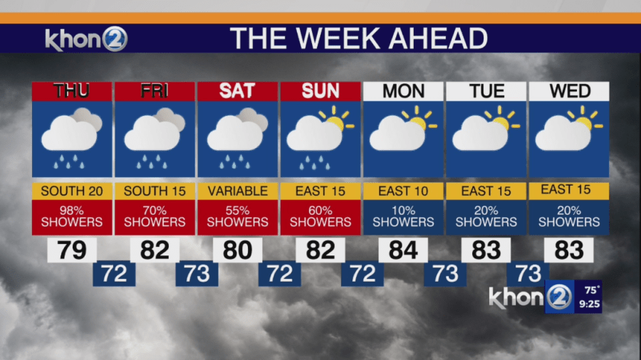
HONOLULU (KHON2) A weakening cold front is moving towards Kauai and Niihau from the northwest, bringing deep, unstable tropical moisture to the islands due to southerly winds. With already saturated soil, additional heavy rainfall could quickly lead to runoff and flash flooding. Therefore, a Flood Watch remains in effect for most of the state, except for the Big Island, which is currently at a lower flood threat level.
Kauai County and Oahu
By early Thursday morning, the cold front will reach Kauai County, interacting with the unstable tropical air mass. This will lead to increased unstable moisture over the mountains of Kauai and Oahu. This raises the flood threat due to moderate to heavy showers and thunderstorms. The deep plume of tropical moisture will persist over Kauai County and Oahu through Friday. Medium-range forecasts indicate drier and more stable southeasterly winds by Friday night into Saturday morning as the Kona low moves north. However, any delay in this transition could prolong the wet weather.
Maui County
Southerly Kona winds will bring deep tropical moisture to Maui County, resulting in bands of moderate to heavy showers over the next few days. These storms could produce 1 to 2 inches of rain per hour, leading to rapid runoff and flooding. Conditions can deteriorate quickly.
Big Island
Tropical moisture will continue to affect the Big Island into Friday, with the southeastern slopes at the highest risk for heavy rain. Most deep convective showers are expected to stay west of the Big Island, with only a slight risk of flooding in Hawaii County.
Sunday through Monday
A transition to drier weather is expected as high pressure builds in from the east, bringing more stable southeasterly winds. The Kona low will drift farther north, leading to improved weather conditions across the Hawaiian region.