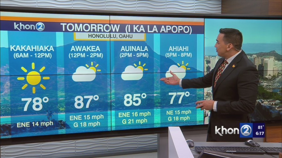
HONOLULU (KHON2) – A stable, moderate trade wind flow will continue to focus limited rainfall over windward slopes into tomorrow.
Broad surface high pressure driving the trades is bisected in the far northern Pacific by a large, but somewhat weak, area of low pressure.
As this low lifts northward on Monday, trades may increase only slightly.
Meanwhile, a strong mid- to upper-level ridge parked over the islands will maintain very stable conditions with an inversion based around 5000 to 7000 ft.
With little organized moisture noted just upwind to the state, expect light rainfall accumulation along windward slopes through the day on Monday, and aside from a few afternoon showers on the Kona slopes of the Big Island, leeward areas will be dry.
Trade winds will strengthen as showers pick up Monday night and Tuesday.
Trades winds increase to locally breezy levels as the broad ridge to the north builds and the surface low lifts northward.
A batch of shallow moisture, currently located about 250 miles east of Hilo, will bring increased showers Monday night, followed by another area on Tuesday night.
The mid-level ridge will initially hold, limiting shower intensity.
A mid-level trough approaching from the southeast will lead to borderline Wind Advisory conditions on the high summits of the Big Island.
The mid-level trough will weaken as it passes over the islands on Thursday, causing winds on the summits to decline and likely having minimal influence on rainfall.
Breezy trade winds and a somewhat dry and stable summertime pattern of mainly windward showers will prevail Friday into next weekend.