HONOLULU (KHON2) – Breezy trades will persist into Sunday as the robust surface high passes far north of state, followed by a very gradual easing later Sunday and Monday as the high travels to the east.
A sharp upper- level trough will linger near or just northwest of Kauai through Tuesday then swing southward Wednesday, maintaining enough instability for some heavier showers in the trade flow, mainly over windward slopes.
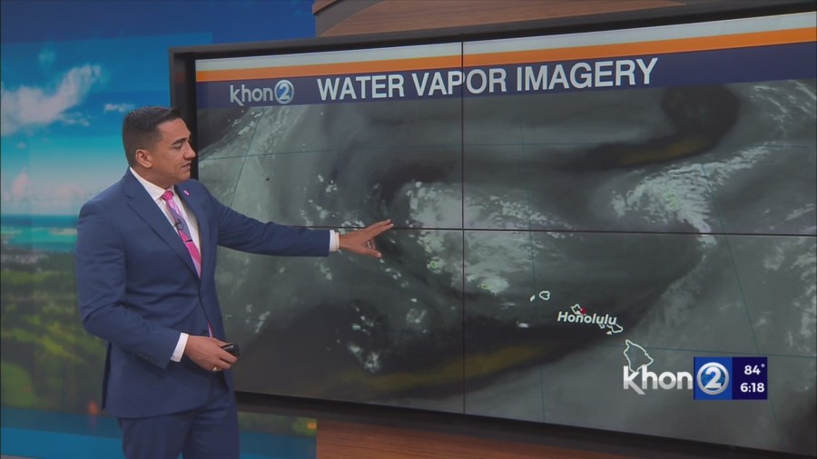
No highly organized areas of moisture are seen, but models are hinting at some pockets of potentially enhanced rainfall favoring windward areas of the Big Island and Maui on Monday and Tuesday.
Most leeward areas will only experience a brief passing shower, but the Kona slopes of the Big Island will likely have spotty afternoon and evening showers, some heavy with a slight chance of a thunderstorm.
Guidance is in fairly good agreement that trade winds will strengthen Thursday and Friday.
Even though a sharp upper-level trough may persist near the islands, mid-level ridging should bring increased stability, favoring less intense showers.
Small Craft Advisory until 6 PM HST Sunday for Maalaea Bay, Pailolo Channel, Alenuihaha Channel, Big Island Leeward Waters, Big Island Southeast Waters.