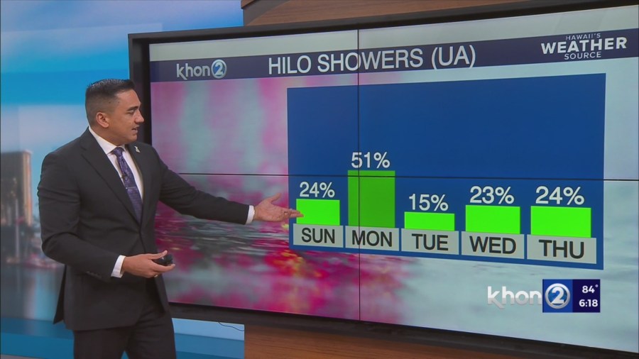
HONOLULU (KHON2) – Trade winds will remain in the moderate to locally breezy range on Sunday as high pressure holds far northeast of the state, and somewhat dry conditions will prevail as precipitable water values fall below seasonal normal.
Expect modest showers to be confined to windward areas, and with the exception of a few afternoon showers on the Kona slopes of the Big Island, leeward areas will be rather dry.
Another area of enhanced moisture will pass over the islands Monday afternoon into Tuesday.
The upper-level low currently near the state will retreat northward, and a building mid-level ridge will bring stable conditions.
Trade winds will be slightly weaker and more easterly than usual, which could keep the bulk of the moisture just north of the islands.
Regardless, expect an increase in showers on windward Big Island midday Monday, spreading the central islands Monday night, then pushing westward to Kauai and Oahu on Tuesday.