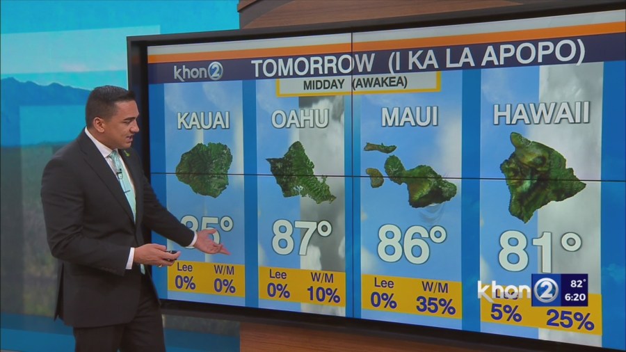
HONOLULU (KHON2) – Locally breezy trades prevail beneath a stout inversion which slopes gently upward from around 5kft at Lihue to 8kft at Hilo.
Shallow saturation around 3kft in depth atop the boundary layer supports isolated to scattered light showers that will increase in coverage tonight through early tomorrow morning.
Flat, textureless stratocu on visible imagery are symptomatic of the resident high stability environment and will change very little during the next few days, particularly as easterly dry advection centered around 700mb reinforces existing stability.
Further north, a cold front extending from low pressure in the Gulf of Alaska is draped along and south of 40N.
The long range guidance maintains solid consensus that this front will seed the trades with deeper moisture late this week as building high pressure pinches off the tail end of the front.
This moisture then pivots toward the Hawaiian Islands bringing an increase in trade wind showers by week’s end.