HONOLULU (KHON2) – High pressure centered northeast of Hawaii will drive moderate to fresh trade winds with dry and stable weather into next week.
Visible satellite shows cloud build ups over lower slopes on the Big Island, and a few cirrus clouds passing over the state.
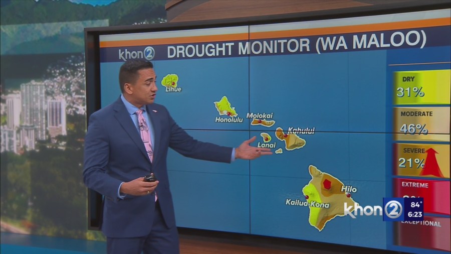
Otherwise conditions are mostly sunny to partly cloudy with virtually no precipitation observed on radar.
The overall pattern will change little through Monday, with the best chance for rainfall and cloud cover over the windward slopes, but accumulations will be light.
A tropical wave will pass south of the state Tuesday through Thursday.
Upper level troughing will set up over the state around the same time may act to enhance showers moving in on both the trade wind flow and the far northern periphery of the wave.
Clouds and showers will likely increase during this time frame focusing over windward and mauka areas.
The upper trough may become an upper low and deepen next weekend possibly further enhancing rainfall.