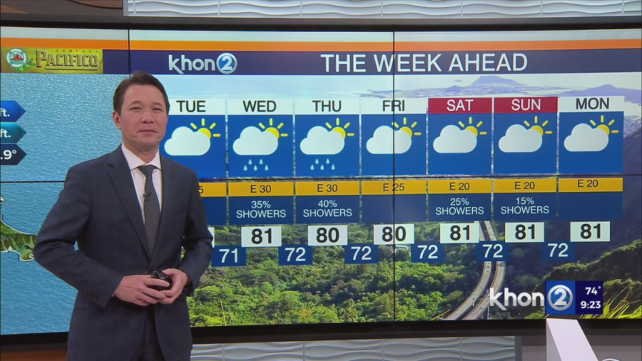
HONOLULU (KHON2) — Breezy and showery trade winds are expected for the week, favoring windward and mauka locations with clouds and showers. The trade winds might weaken a bit over the weekend as the high to the north weakens.
Overall, generally calm conditions persisting throughout the week, thanks to the subtropical high remaining intact to the north. Northeast trades will moderate to breezy, shifting eastward overnight into Tuesday, accompanied by a band of moisture moving southward into the area. This moisture will linger through Tuesday, gradually diminishing by midweek. Consequently, windward and mountain areas can expect showery conditions, with some showers reaching leeward sections of the smaller islands during the overnight and morning hours. Rainfall accumulations in windward/mauka regions could range from 1-2 inches over the next few days due to the steady development and movement of mostly light showers.
The breezy easterly trades may ease slightly over the upcoming weekend and early next week as the ridge weakens in response to deep low pressure forming northwest of the state near Midway.
Small Craft Advisory until 6 AM HST Wednesday for Oahu Leeward Waters, Kaiwi Channel, Maui County Windward Waters, Maalaea Bay, Pailolo Channel, Alenuihaha Channel, Big Island Leeward Waters, Big Island Southeast Waters.