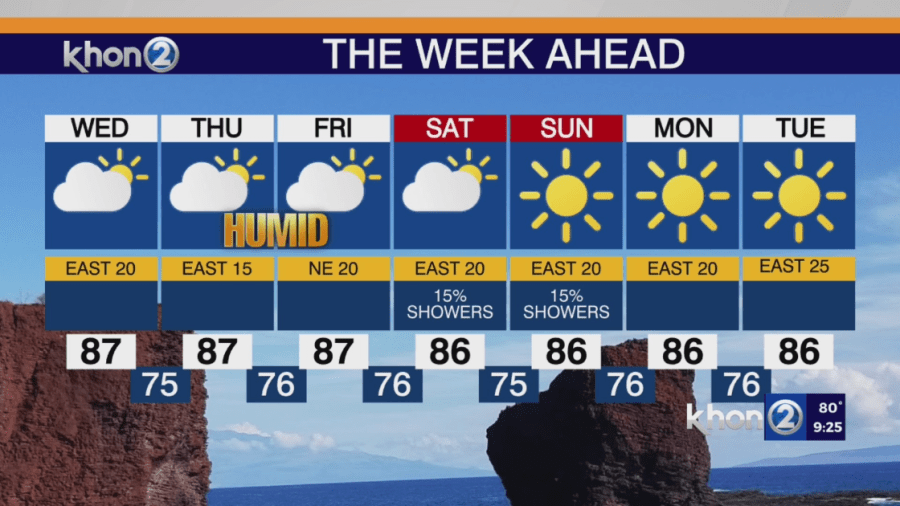
HONOLULU (KHON2) — A area high pressure will stay over the region but start to weaken as an upper low moves southeastward toward the area tonight through Wednesday. A front is expected to stall several hundred miles north of the state from Wednesday through the end of the week. This change will cause the trade winds to become lighter and shift slightly to the southeast. Most of the moisture and instability will stay north of the islands, so the weather will remain mostly dry and stable. Light showers will continue to occur mainly in windward and mauka areas, especially at night and in the morning. However, the front’s proximity to the western and northern parts of the island chain might cause some increased shower activity there toward the end of the week. As the winds weaken, localized sea breezes are likely, especially over the western half of the islands. While the weather will generally be stable, there could still be some clouds and brief showers in interior and leeward areas where sea breezes form. Breezy trade winds are expected to return later this weekend and into early next week as high pressure moves back in and moisture to the north decreases.