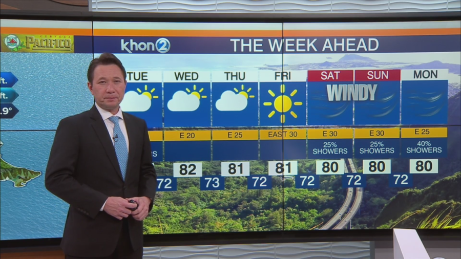
HONOLULU (KHON2) — For the first half of the work week, light to moderate trades will dominate the islands. Dry weather will persist until Wednesday, with occasional overnight and morning showers in windward areas, followed by afternoon showers in interior and leeward regions. By Wednesday night and Thursday, breezy to strong breezy trade winds will return, a shift to more typical trade wind conditions. From Thursday night through early next week, expect strong trade conditions conditions overall, accompanied by an increase in trade wind showers as adisturbance moves across the islands.
Tonight, a weakening front lies approximately 400 miles west-northwest of Kauai, while a high-pressure system of 1030 mb sits about 1700 miles northeast of Honolulu. Moderate trade winds prevail in the eastern islands, while lighter winds persist in the west. Cloud cover is a mix of high and low clouds, resulting in mostly cloudy conditions across most areas, with scattered showers observed in Kauai County and isolated windward showers elsewhere.
Mostly dry conditions will persist across the islands until Wednesday, with brief passing showers in windward areas overnight and in the morning, along with afternoon showers in interior and leeward regions. A transition to a more typical trade wind pattern is anticipated by Wednesday night and Thursday, with potentially wetter trade wind conditions from Friday through early next week a upper level low lingers near the islands.