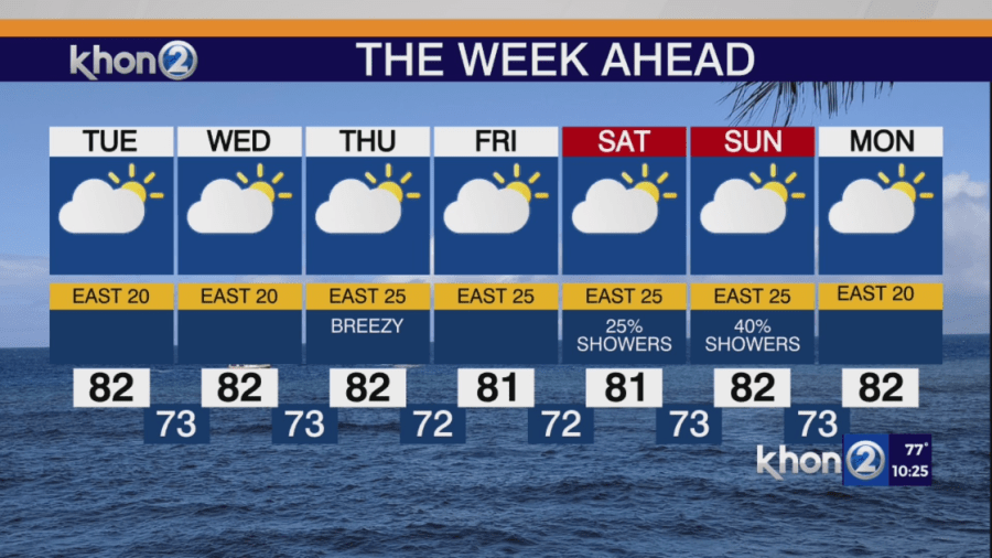
HONOLULU (KHON2) — Moderate to locally breezy trade winds are strongest over the eastern end of the state tonight with satellite images showing mostly cloudy skies with a mix of high and low clouds. Radar shows isolated to scattered showers moving into windward slopes and coasts, mainly affecting the Big Island, while leeward areas remain mostly dry, except for a few showers on the Big Island.
In the next few days, high pressure will build eastward and strengthen well north of the state, while the low-pressure trough stays nearly stationary west of the islands. This will keep trade winds in the moderate to locally breezy range. By Thursday and Friday, the low will move westward and weaken, with high pressure northeast of the state moving closer to the islands over the weekend. This will slightly increase trade wind speeds, maintaining moderate to breezy conditions into early next week.
Relatively dry trade wind weather is expected in the next few days, with showers favoring windward slopes and coasts, especially at night and early morning.