HONOLULU (KHON2) – At the surface, a strong high to the far northwest of the state and a weaker high to the far east-northeast are separated by a northeast-to-southwest oriented front heading eastward towards the West Coast of the mainland.
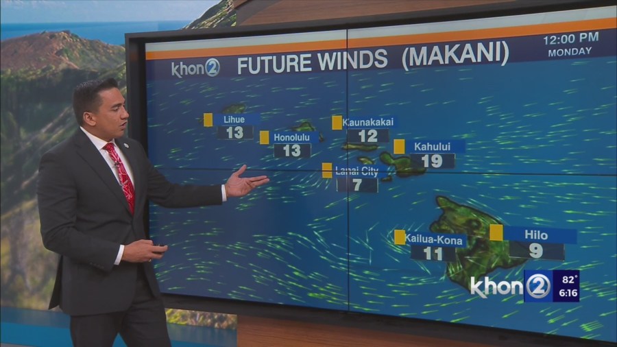
This pair of highs will continue to bring moderate to locally breezy trade winds to the island chain through this weekend.
As a broad low develops to the distant northeast early next week, it will weaken the high to the northwest, relax the local pressure gradient, and bring lighter trade winds to the area.
This weaker flow will persist through much of next week and may allow for sea breeze development across some leeward areas, increasing clouds and bringing a slight chance of rain.
Looking aloft, the upper level low that’s been responsible for enhancing tradewind showers over the last day or two will gradually push eastward and away from the state over the next couple of days, with mid level ridging building overhead in its wake.
A weak upper level trough/low will develop near the northwestern end of the state midweek, and sweep across the state on Wednesday.
While this feature will introduce some instability aloft, moisture will still be limited, so not expecting it to cause much of an uptick in showers at this time.
A strong mid level ridge will quickly build overhead in its wake, bringing more dry and stable conditions through the rest of the week.
Small Craft Advisory until 6 PM HST Sunday for Maalaea Bay, Pailolo Channel, Alenuihaha Channel, Big Island Leeward Waters, Big Island Southeast Waters.