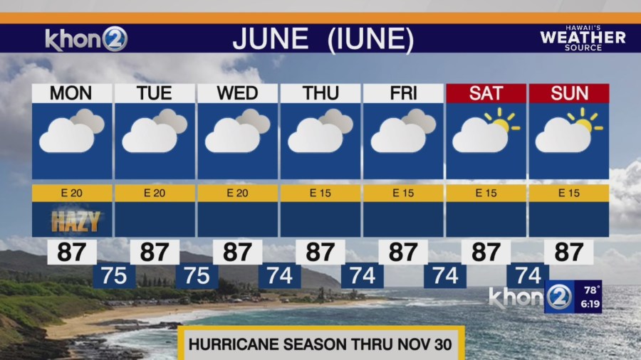
HONOLULU (KHON2) – This moderate to locally breezy east-southeasterly low level flow pattern is expected to continue through tomorrow.
Clouds and showers will favor windward and mauka areas during the overnight to early morning hours and leeward and interior areas during the afternoon hours as sea breezes develop.
This flow can also cause low level convergent boundaries that form downstream of each island to provide additional showers to their neighboring downstream islands as they line up along the island chain, as has been the case this afternoon…particularly across Oahu.
Shower activity may be slightly enhanced across the western end of the state through tomorrow as both an upper level trough/low dives south to the west of Kauai and brings instability aloft and low level moisture is filtered across the area.
A return to breezy and more stable trade wind conditions is expected by tomorrow night as upper level heights rise, drier air filters in from the east, and the surface trough weakens and moves away from the state.
This will result in a more typical easterly trade wind pattern through at least Thursday, with showers favoring windward and mauka areas and generally dry conditions prevailing elsewhere.
Small Craft Advisory until 6 PM HST Monday for Maui County Windward Waters, Pailolo Channel, Alenuihaha Channel, Big Island Windward Waters, Big Island Leeward Waters.