HONOLULU (KHON2) – A front far northwest of the islands will shift southeastward over the next couple of days, eventually weakening into a broad trough across the islands on Friday.
Trades will ease over the next few days in response.
Expect light to moderate trade winds over the eastern islands tonight and Thursday, while lighter trades allow development of land and sea breezes across leeward areas of the western islands.
Through Thursday, expect showers to favor windward and mauka areas overnight and during the morning, then transition over to interior and leeward areas each afternoon into the early evening.
As the boundary layer flow becomes light and variable Thursday night, most showers should remain offshore.
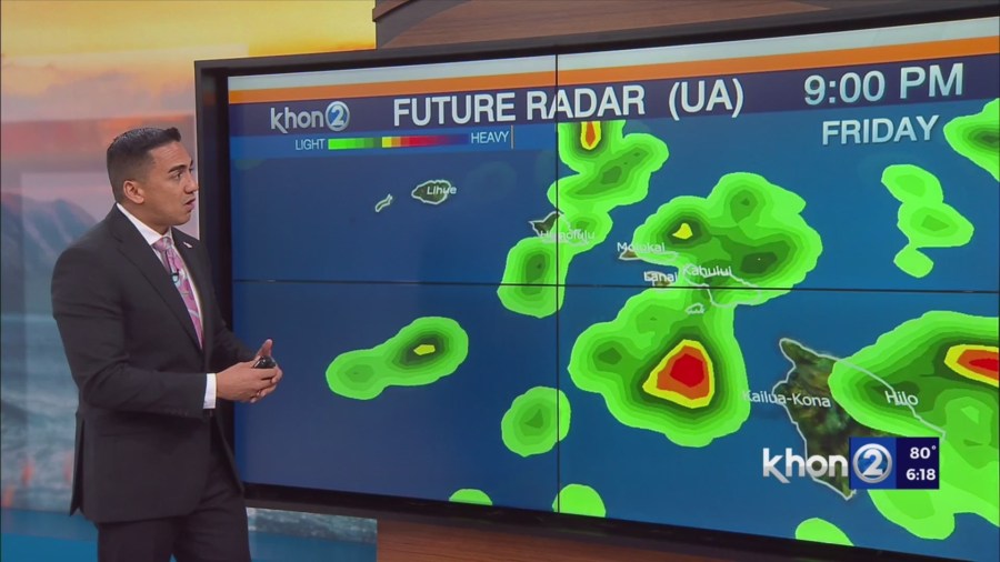
Models show trades will decrease further on Friday, allowing for sea breeze development statewide.
Trades may strengthen over the weekend as the broad trough gradually weakens.
By early next week, another front northwest of the state will cause surface flow to veer to southeasterlies across the western islands while trade flow persists across the eastern islands.
Models show an upper low will move across the chain Friday through Saturday.
Associated cold air aloft will destabilize our airmass and introduce the possibility of thunderstorms.
At this time, predicted PW does not appear to be high enough to fuel a widespread heavy rain threat.
However, brief heavy downpours associated with possible thunderstorms would cause minor flooding impacts.
Models also depict a potential for severe thunderstorms, with steep lapse rates, high CAPE, and strong bulk shear.
If these conditions were to develop, stronger thunderstorms would be capable of producing hail and strong gusty winds.
Expect a return of a hybrid trade wind pattern by Saturday night, featuring windward and mauka showers at night, followed by interior and leeward showers during the afternoon and early evening hours.