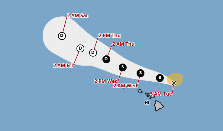
HONOLULU (KHON2) — The storm once known as Hurricane Kiko is now officially Tropical Storm Kiko, with the storm expected to continue weakening as he travels north, missing the Hawaiian Islands.
Kiko began the morning of Sept. 9 travelling at 14 mph with sustained winds of 60 mph, but he lost some wind power as the morning went on, now sustaining winds of 45 mph.
As of this morning, Tropical Storm Kiko is north of Hawaiʻi Island as he continues his northwesterly travel avoiding the islands.
With his northern path, those in the islands can expect sporadic rain showers, with the chance of rain sitting at a comfortable 30% to 40%, which is just slightly higher than usual.
Tropical Storm Kiko’s northern position has brought a temporary halt to the trade winds, causing a significant amount of humidity in the islands on Sept. 9 and Sept. 10.
Additionally, his effects on the surrounding ocean has brought a high surf warning to the islands, with particularly strong surf on east-facing shores.
As Kiko passes the islands, be sure to stay in touch with Hawaiʻi’s weather team of Brittni Friedlander, Kamaka Pili and Justin Cruz daily on KHON2 as they begin to say aloha to the storm.