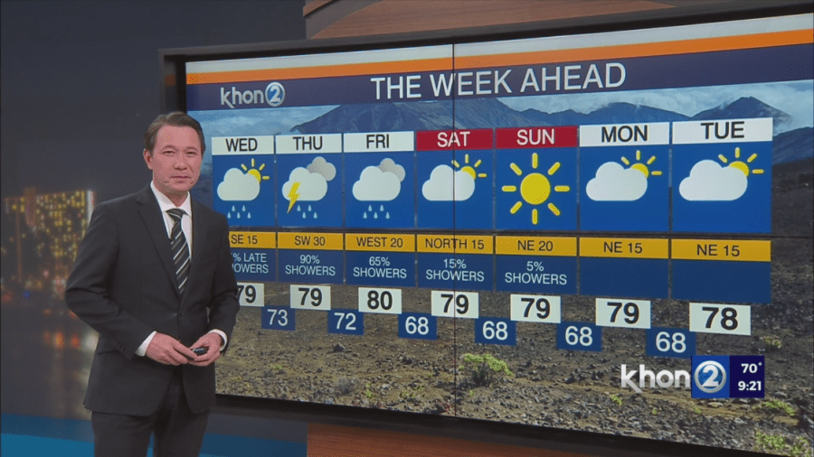
HONOLULU (KHON2) — A potent low pressure system currently northwest of the Hawaiian Islands could bring strong winds, heavy rain and thunderstorms to the islands starting late Wednesday. Heavy rain and thunderstorms could impact all islands through early Friday. In addition to the potential for thunderstorms, strong south or southwest winds may impact the state will downed trees and isolated power outages. The threat of heavy rain will diminish this weekend.
- Strong Storms & Flooding:
- Heavy rain and strong thunderstorms are likely from Wednesday night through Friday.
- Flash flooding is a significant concern.
- High Winds:
- Strong winds are expected across many islands.
- High wind watches/warnings possible for some areas.
- Winter Storm:
- Winter storm watch possible for Big Island summits.
- Cooler & Drier:
- Much cooler and drier weather will arrive Friday night and continue through early next week.
Key Points:
- Unstable Air: Moist and unstable air will move in.
- Strong Winds: Southerly winds will increase significantly.
- Potential for Severe Weather: High risk of severe thunderstorms, flash flooding, and strong winds.
- Stay Informed: Monitor weather updates closely.
Important Notes:
- A Flash Flood Watch in place for all islands starting Wednesday lasting through Friday.
- A Winter Storm Watch is possible for Big Island summits.
- High Wind Watches in place for all islands starting Wednesday lasting through Friday.