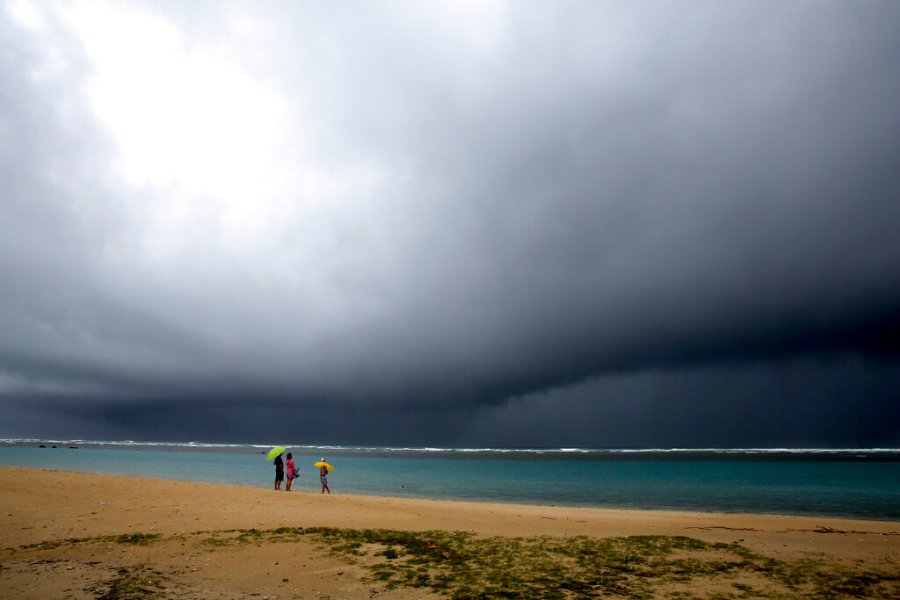
HONOLULU (KHON2) — The first winter storm of the season is expected to impact the Hawaiian islands as early as Wednesday evening through Friday.
On Monday, the National Weather Service in Honolulu issued a special weather statement stating an “unusually strong low pressure system” will pass north of the state on Thursday bringing a multi-faceted threat for significant weather to the Hawaiian islands.
The statement adds there is an enhanced risk of strong to severe showers and thunderstorms with a primary threat of damaging wind gusts, particularly over the western end of the state.
Officials are prepping for the bad weather and asking residents to do the same.
Parts of Oahu saw seven inches of rain overnight Sunday into Monday which resulted in multiple power outages across the windward side. The NWS said the approaching storm will be much larger than Sunday’s passing storm.
“The outages were all largely weather related, it varied depending on the area and which outage, but largely we’re talking about the impacts from heavy rain and severe weather such as downed trees or other objects coming into contacts with the lines,” explained HECO spokesperson Darren Pai.
The National Weather Service says windward sides of Kauaʻi and Oahu are at risk for damaging downslope winds Wednesday night through Friday.
“The track and intensity of this system, how close it gets to the islands, is going to determine how bad things get,” explained NWS Honolulu Science and Operations officer Robert Ballard.
“But if there’s strong winds associated with thunderstorms, those could affect pretty much any part of the islands, including Maui County and the Big Island,” Ballard added. “Also flash flooding, that would be just about anywhere.”
The NWS said leeward sides could see the most rainfall totals from the approaching storm.
“I’m afraid that with some of these thunderstorms coming through, we’re going to see really heavy rainfall rates that that are going to overwhelm and it will help the drought situation, but it’s also not all going to soak in effectively, and a lot of it will turn into runoff,” Ballard continued.
He said areas prone to power outages from strong Kona wind events will have a greater chance of outages.
“We want folks to kind of start thinking about preparing for both, like, power outages and some wind damage possibilities. Then also if you’ve got a camping trip or something later this week planned where you’re going to be away from civilization, you don’t have your cell phone, can’t check the weather, that’s probably not a great idea, you might want to reschedule,” Ballard continued.
Kauaʻi County is also asking people to avoid outdoor activities and reminding drivers Kuhio Highway at Hanalei bridge could close with little to no warning.
The Honolulu Department of Emergency Management said its monitoring the system to see if additional prep is necessary.
HECO said it has been maintaining trees and branches in the mountains near transmission lines on a regular basis but wants customers to be prepared.
”Officials with the National Weather Service are forecasting severe weather from a strong low-pressure system that will pass north of the state later this week,” said Kaua‘i Emergency Management Agency Administrator Elton Ushio. “Given the nature of heavy rain events on Kaua‘i, we urge everyone to stay vigilant and avoid outdoor activities in flood-prone areas like roadways, hiking trails, rivers/streams, and low-lying areas.”
Officials advise the public not to call Kaua‘i Police Dispatch for weather-related or road conditions, as these calls significantly interfere with regular work. For road and closure conditions, call 808-241-1725. For weather questions, contact the National Weather Service automated weather line at 808-245-6001 or visit www.weather.gov/hfo.