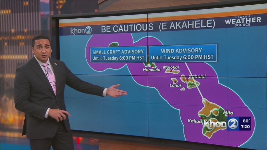
HONOLULU (KHON2) – Strong high pressure to the north of the state will maintain a tight pressure gradient across the island chain and help drive breezy to windy trades through tomorrow.
At the same time, a mid level ridge will remain situated over the state, maintaining stable conditions with temperature inversions lowering through tomorrow, which may help to enhance downsloping winds across lower elevation leeward communities.
As such, a Wind Advisory remains in effect for the typical windier portions of Maui County and the Big Island through 6 PM HST tomorrow.
The summits of Mauna Kea and Mauna Loa have also been included in the Wind Advisory as a mid level easterly jet streak moves overhead this evening through tomorrow.
This afternoon’s radar and satellite imagery show clouds and showers moving into windward and mauka areas on the trades.
Upstream moisture suggests that clouds and showers will focus over the eastern end of the state, with some drier air expected to filter over across the smaller islands tonight into tomorrow, helping to limit shower coverage across these areas.
Breezy to windy trade winds with stable and relatively dry conditions will persist through tomorrow.
Minimum relative humidity at lower leeward elevations will likely fall to around 45 percent each afternoon, and with the inversion dropping to as low as 5,000 feet, winds will become gusty over and downwind of island mountains.
This will result in near critical fire weather conditions over dry leeward areas at times, though no headlines (watches or warnings) are due since the Keetch Byram Drought Index will remain below the 600 threshold at Honolulu.