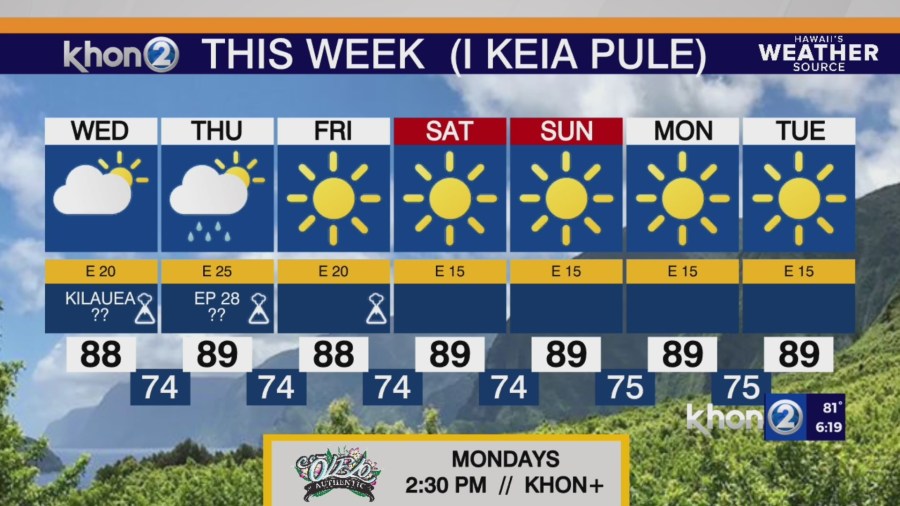
HONOLULU (KHON2) – Strong high pressure north of the Hawaiian Islands will maintain breezy to windy easterly trade winds across the state.
In addition, the relatively dry humidity levels will combine with the strong winds to keep elevated fire weather conditions across the state, mainly over drier and windier leeward areas.
Satellite imagery this afternoon continue to show bands of fairly stable clouds moving into windward and mauka areas, with radar imagery showing light passing showers moving across the islands.
The ridge aloft continue to keep inversion heights around 5,000 to 6,000 feet this afternoon based on soundings at Hilo and Lihue.
A strong high pressure ridge north of the Hawaiian Islands will keep breezy to windy trade winds in the forecast for one more day today.
The strongest winds will develop over the windier areas of Maui and Hawaii Counties.
Dry weather conditions will combine with these strong gusty winds to produce elevated fire danger across the state each afternoon, mainly over the drier leeward slopes.
Wind speeds will decrease from Wednesday onward.
A slight increase in shower trends remains in the forecast from Wednesday night onward.
The temperature inversion near Maui and the Big Island today will range from 5,000 to 6,000 feet elevation.